 Thanks to Mark Samson of Waihi for help in putting this Guide together.
NEARBY TOWN/CITY: Waihi (11 kms, 10 mins drive); Paeroa (15 kms, 20 mins drive)
EXACT LOCATION: DoC Campground at END of Dickey Flat Road – see map
TOTAL ROUTE DISTANCE: 41 kms (with a shorter option of about 25kms that avoids the most hilly and technical sections)
TOTAL ASCENT: 1,850m; TOTAL DESCENT: 1,850m
TIME TO RUN: 5 hrs (Elite) to 9 hrs (Weekend Warrior) NB NOT suitable for novices. A couple of worthwhile side trips add half an hour.
TYPE OF TRAIL RUN:Loop
DIFFICULTY: Hard/technical, definitely not a run for novices.
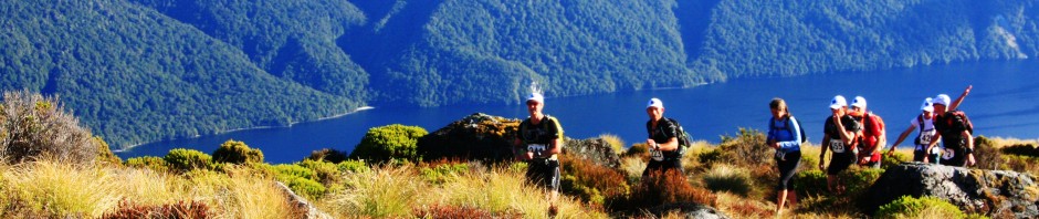
DEFINING CHARACTERISTICS: Steep ascents, 95% single-track (a lot of which is technical), stream crossings (can be high after rain)
FEATURES OF INTEREST: Beautiful regenerating bush, large kauri trees, second highest waterfall in the North Island (Ananui Falls), numerous stream crossings, huts, the Waitawheta Tramway, swing bridges & gorges.
START GPS: 37°26.308’S; 175°44.855’E
FINISH GPS: 37°26.308’S; 175°44.855’E
ONLINE REFERENCE: Garmin Connect
BEST MAP/S: Old NZMS 260 series: T13 or Topo 50 series: BC35 Paeroa & BC36 Katikati. Or print off this map.
RUN IT: From the Dickey Flat car park take the Mangakino Pack Track south towards Daly’s Clearing Hut. This pretty much follows the Waitawheta River, which after a couple of kms is crossed (caution – can get high after rain) before ascending through beautiful regenerating bush. About 6 kms from the start take a left turn on Dean Track, following the sign to Franklin Road. Descend through bush before breaking out on to farmland with wide views all around. Follow this straight on over a few stiles untilFranklin Road is reached. Turn right following signs forWaitawhetaValley and follow farm track for a couple of kms before turning left on to Bluff Stream Kauri Loop Track (to Kauri Trees andAnanuiFalls). A couple more stream crossings and a steep climb take you to the site of two spectacularly large kauris. At this point you also have the option of following the track past the kauri trees and continuing down a steep descent to get back to the Waitawheta River and complete a shorter loop. If doing the big loop keep following the track uphill towards theAnanuiFalls. The next 10 kms or so are steep, rough and technical so be prepared. TheAnanuiFalls are a worthwhile side trip before dropping steeply into the next river valley. At the next junction turn right to cross the river following the sign for Waitawheta Hut. A very technical section of bush running follows. The hut itself is accessed via a bridge across a spectacular gorge but the route lies straight ahead on the Waitawheta Tramway. The next few kms are relatively easy running following the old tramway as it criss-crosses the gorgeousWaitawhetaRiver. On reaching Dalys Clearing Track turn left and climb the hill to Daly’s Clearing Hut. A short way past the hut turn right on to the Mangakino Pack Track again and follow this for a couple of kms to complete the big loop section of the run. For the final 6 kms you’ll be re-tracing your steps from the start of the day.
POST RUN GOODNESS:
The Talisman in Karangahake Gorge
The Waikino Station Café – and you can catch the train into Waihi
Ti Tree Café – for sustenance in the sunny courtyard
Kava Café – for awesome pizza
Waitete Orchard Café & Restaurant – for a-la-carte dining and the world’s best ice cream!
You also need to visit Waihi to peer into the 200m deep Martha Gold Mine and take a leisurely stroll around the 4km Pit Rim Walkway
See this Guide in PDF format – Kaimai Killer Trail Guide

This has to be one of the coolest sites on the web. Well done!!! I live in Tauranga and my aim is one day to run the entire length of the Kaimai’s. 80 oddk’s I think. should take a couple of days but it would be magic. We should make it a group run.
Sounds like a quest! The Kaimai’s version of the Hillary Trail? Wait til summer and do it in a day. Or don’t wait, and start at midnight…
I’m looking forward to getting my hands on the Kaimais before too long. This here looks like a classic run.
Made it to the Kaimais at last! Ran around Karangahake gorge, over the mountain, and started this run here from Dickey’s Flat, but the bucket load of rain meant the first river crossing 20mins south of Dickey’s Flat was impassable. We had to bash up through some farmland and road bash home…
I live in the Kaimais and run the network of tracks year round.A group of us ran from the K Gorge ,up the side of Te Aroha and out to Wharawhara rd.It was about 70k and wasnt even half way.From Whara whara to the otherside of Thompsons Track is very over grown but from there out to S.H 29 is nice and easy with lots of tramlines.
This 60k run looks very cool and a good warm up for the Kauri 70k.
Im in.
Gotta love those Kaimai hills Darren – I’m keen to do the south-north traverse of the whole range come summer…. are you keen?
just clicked on and see that the 60k has been canned. Anyone know why?
Very dissapointing.
Not enough entries to warrant all the extra work/cost of extending the course I believe. Shame, but the marathon course is still a cracker.
Anyone interested in doing some long day or multi day runs through the kaimais this winter?
Just back from an attempt at waitawheta hut…but rivers too flooded to cross so stayed at Daly’s clearing hut instead, and back via Dean’s track. Lovely single track for running!