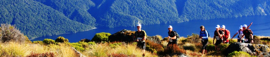

7in7 runners on the high point of the run - it's all downhill from here!
NEARBY TOWN/CITY: Arrowtown
EXACT LOCATION: Car Park at bottom of Arrowtown (beside Chinese Miners Camp)
TOTAL ROUTE DISTANCE: 20.7 kms
TIME TO RUN: Elite 2¼ hrs; Novice 4½ hrs
TOTAL ASCENT: 960 metres
TOTAL DESCENT: 960 metres
MIN ELEVATION: 412m MAX ELEVATION: 1058m
TYPE OF TRAIL RUN: Loop
DIFFICULTY: Moderate
DEFINING CHARACTERISTICS: Great variety of terrain – river bed, 4WD track, open single track and some beautiful beech forest. Part of the circuit is a marked route rather than signposted trail so make sure to take a map (and compass in case of bad weather)
FEATURES OF INTEREST: Lots of gold mining history and great views, especially on descent from Big Hill back to Arrowtown
ONLINE REFERENCE: See the Garmin Connect activity profile
BEST MAP/S: Topomap F41
RUN IT:
From the Chinese Camp cross Bush Creek on a small wooden bridge, turn right and head up the Arrow River for 100m or so, then left onto a track just beside the pipeline of the Arrow irrigation scheme.
Follow this wicked bit of single track north for a couple of kms and cross the Arrow River on the footbridge. Then turn left on to the 4WD track. Follow this as it climbs high above the river, crosses Brackens Gully and descends again.
Shortly after crossing Soho Creek (about 6.5 kms into the run) there is a small section of single track leading to a footbridge across to the western (true right) side of the Arrow River. Keep heading up valley on the 4WD road for about another 4 kms. There are a few places where the road fords the river but you can usually find a way through on the same side to avoid wet feet if you wish.
After about 10kms you reach the site of the derelict Mt. Soho homestead (not massively obvious) and then you’ll see Eight Mile Creek (or Coronet Creek as it is sometimes known) merging with the main valley from the left. Head west into Eight Mile Creek (the route is easy but not particularly well marked) and follow the sketchy farm track upstream for a short distance while looking out for poles that mark the beginning of Big Hill Track (on your left as you head upstream).
The Big Hill track starts with a steep uphill grunt (a bit scrubby in places). Follow the marker poles uphill bearing towards the south east as you get higher and follow the valley that leads to the saddle just below Big Hill. The total climb from Eight Mile Creek is 400m over about 2.4 kms.
The best bit of the run is now about to start! From here it’s pretty much unbroken downhill on great single track all the way back to Arrowtown. Follow the track down for several kms until you reach the junction with Sawpit Gully Track. Turn right and keep heading downhill to the junction with Bush Creek Track. Turn left and follow the pipeline back out to where you started.
POST RUN GOODNESS: Arrowtown is a bustling tourist centre with lots of good eating places and some great ice cream.
The PDF version of this Guide is here: Big Hill Circuit
