 Thanks to Alistair McAlpine for this guide.
NEARBY TOWN/CITY: Upper Hutt
DISTANCE FROM TOWN CENTRE: 12km/10min
EXACT LOCATION: Pakuratahi Forest, Wellington, New Zealand. By car from Wellington, take SH 2 and turn right at Te Marua (7.5km north of Upper Hutt). Follow Plateau Road to its end to reach Tunnel Gully. The run starts from the upper car park of the Tunnel Gully Recreational Area, at a sign-posted white metal gate.
TOTAL ROUTE DISTANCE: 12km
TIME TO RUN: Elite 1h 15 mins; Novice 2hrs 45 mins
TOTAL ASCENT/DESCENT: 610m of altitude – average gradient 14% (sections of 20%)
TYPE OF TRAIL RUN: Out and back
DIFFICULTY: Easy track | tough gradient.
DEFINING CHARACTERISTICS: Gravel and clay access road
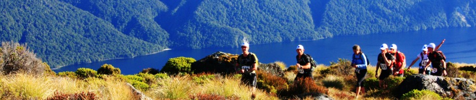
FEATURES OF INTEREST: Breath-taking 180° vistas across Wairarapa, Cook Strait, Wellington and Hutt Valley. As Mount Climie Ridge is the tailbone of the Rimutaka range that separates Wairarapa from Upper Hutt it cops weather from all directions including snow and ice in winter.
BEST MAP/S: Parks and Recreation map
RUN IT: Looking for hill work on a non-technical trail? Consider Mount Climie. Carry water as the route is dry and chuck in a jacket.
From the white gate at the end of the car park settle into your work on the gravel access road. Your goal is a scattering of communication towers on the open ridge above and you won’t lose your way on this run even in the dark.
A few minutes in you’ll notice a trail dropping away to your right through northern rata, miro and rimu. This fire-break is frequented by mountain-bikers, walkers and the occasional horse rider, stay on the main trail. Tane’s Track is signposted to your left a little further up but stick to the relentless gravel track. You’ll know you’re gaining altitude when the surrounding bush changes to kamahi and beech forest.
A couple of kilometres up you’ll catch a view through a gap in the vegetation but don’t use this as an excuse to stop, keep plugging. There are a couple of short stretches where the grade eases to get your hopes up, these were included as a joke by those who created this track.
After a winding climb you’ll reach the first communication tower then exit the bush onto open tops at North Climie tower and briefly celebrate. You’ve broken the back of the climb and now only have to run the final kilometre along the ridge to ‘Climie tower No.2’ (860 m).
At the end of the track skirt around the tower enclosure and run the final 100m of single track across the only true snow tussock on the Rimutaka Range. A knoll looks south over stunning views of Wellington Harbour, Mana Island and east over Lake Wairarapa. Or just as likely you won’t be able to see anything because of the cloud.
Beware: Don’t be misled by the boardwalk to the west of the knoll, especially in fog. Yes, this inviting 10m long slope is a quick way down but it is a launching platform for para-gliders and will drop you into the abyss.
The Fig Tree Café closes at 4pm so don’t loiter on Mount Climie. The run down is made more satisfying by the knowledge that you have completed the run up.
POST RUN GOODNESS: You’ll find the Fig Tree Cafe on Fergusson Drive, Upper Hutt. Whatever you do don’t order the berry smoothie it’s so good it must be bad for you and a drink with caffeine rebuilds glycogen stores 66% more than a carb-only drink
View this Guide as a printable PDF file


